ISLAND GEOGRAPHY
CLICK ON
PICTURE FOR LARGE IMAGE
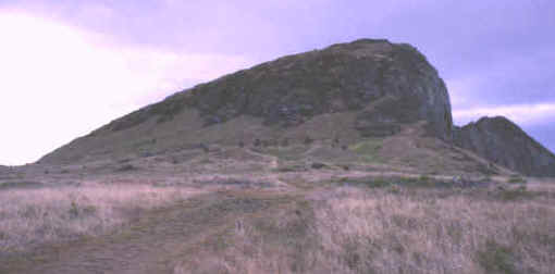
PATHWAY LEADING TO THE STATUE
QUARRIES ON RANO RARAKU
GRAY ROCKS ON THE SLOPES IN THE
DISTANCE ARE BURIED STATUES
EASTER ISLAND
PICTURE
CREDIT GEORGE FRISON
Easter Island, also known as Rapa Nui, is the most isolated island in the
world. It was named by Jacob Roggeveen a Dutch explorer who discovered it
on Easter day in 1722. This 64 square mile speck of land is located in the vastness of the
Pacific Ocean. The closest neighbors are Pitcairn Island 1,400 miles away
to the northwest and South America 2,340 miles to the east.
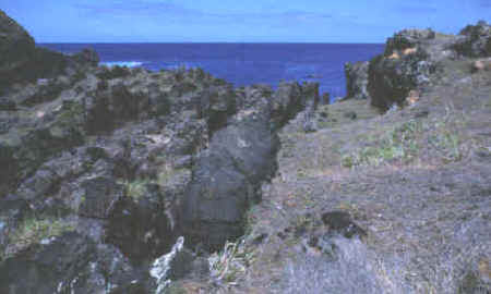
THE ISLAND'S VOLCANIC HISTORY IS
OBVIOUS EVERYWHERE YOU LOOK
EASTER ISLAND
PICTURE
CREDIT GEORGE FRISON
Easter Island was born out of the ocean by volcanic eruptions and in fact
there are over 70 eruptive centers on the island today but none have been
active for well over a thousand years. The island has a triangle shape
that is formed by three large volcanoes located at the corners. The
highest volcanic cone on the island is Maunga Terevaka in the northeast
corner which rises to 1,674 feet.
CLICK ON
PICTURE FOR LARGE IMAGE
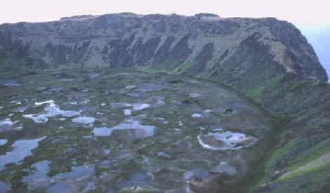
CRATER LAKE IN THE VOLCANO CALLED
RANO KAU
EASTER ISLAND
PICTURE
CREDIT GEORGE FRISON
Rano Kau is one of the
three largest volcanoes on the Island. On it's rim is the location of the
ceremonial village of Orongo where the center of Easter Island's final
phase Birdman Cult was once located. This crater lake is one of three large fresh water lakes on Easter Island.
There are no flowing streams on the island and water has always been collected from
either lakes, pockets of water in the lava flows or from wells. These lakes are covered
with thick layers of totora reeds.
FIRST
PHASE--ISLAND DISCOVERY & DEVELOPMENT
A.D. 400 TO 1000
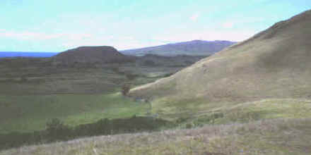
PRESENT DAY EASTER ISLAND IS VIRTUALLY
DEVOID OF LARGE TREES
EASTER ISLAND
PICTURE CREDIT GEORGE
FRISON
One large peopling event
can be accounted for in the archaeological record. Sometime around 1600
to 1400 years ago a few dozen people arrived in ocean going
canoes with all the necessities to support their life in a new land. Some
of the most important supplies they brought with them were chickens,
bananas and sweet potatoes. They also brought pigs, dogs and breadfruit
but these disappear shortly after their arrival. Pollen studies done by
John Flenley, Massey Univ., and Sarah King, Univ. of Hull, show that at
the time these people arrive the land was covered with a lush rain forest
dominated with giant palms which they used to build boats, houses and
later for moving large stones.
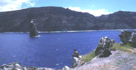
SMALL
OFFSHORE ISLAND LOOKING TOWARDS THE MAIN ISLAND
EASTER ISLAND
PICTURE
CREDIT GEORGE FRISON
All other Polynesian islands, except for Easter Island, had a main diet of
fish. In fact, archaeological excavations in ancient garbage heaps show
that 90% of the bones from those islands were from fish. But on Easter
Island, between A.D. 900 to 1300, less than 25% belong to fish but 33%
belong to porpoise (common dolphin). Easter Island never had the warm
shallow coral reefs to support a supply of fish. Their only option was to
go to sea in large seaworthy canoes to harpoon porpoise that can weigh up
to 165 pounds.
Easter Island is the
only Polynesian island where archaeological excavations show that rat
bones outnumber fish bones. These people were also eating a number of
different species of birds that would have been seasoned with rat meat.
CLICK ON
PICTURE FOR LARGE IMAGE
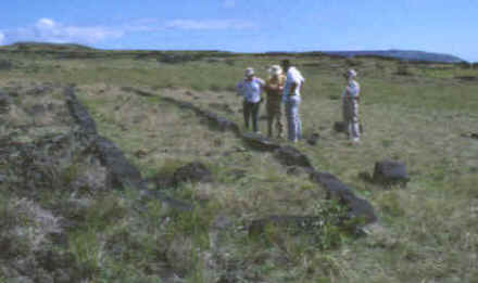
ELLIPTICAL HOUSE FOUNDATION
EASTER ISLAND
PICTURE
CREDIT GEORGE FRISON
These odd foundations were laid down with elongated squared blocks of
basalt. They were fitted precisely together in an elliptical design. Holes
were pecked into the foundation blocks to hold long poles that were bent
and lashed together along with horizontal pieces. When finished, the
structure looked somewhat like an overturned canoe. Along the entrance
side they laid down a pavement of beach rocks.
SECOND
PHASE--STATUE BUILDING
A.D. 1000 TO 1500
CLICK ON
PICTURE FOR LARGE IMAGE
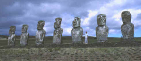
STATUES
("MOAI") RESTORED ON THEIR PLATFORMS ("AHU")
EASTER ISLAND
PICTURE CREDIT GEORGE
FRISON
Possibly as early as 400 years after the first people arrived and during phase two of the
islands cultural development, from A.D. 1000 to 1500, they began to build
larger and larger ceremonial platforms and statues. Most of the island's religious and
social history was based on ancestor worship. They expended a great amount
of labor towards this endeavor. The new trend was disastrous. As
more and more palm trees were cut for logs to move statues & building stones and
hauhau trees to make rope the land began to erode. This in turn caused the
top soil to wash away and crops began to fail.
CLICK ON
PICTURE FOR LARGE IMAGE
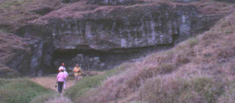
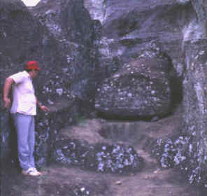
LARGE STATUE IN THE
QUARRY AT RANO RARAKU
EASTER ISLAND
PICTURE CREDIT GEORGE
FRISON
As the frenzy of statue building continued to expand there seems to have
been a contest to construct the most impressive monument. Statues became
larger and some extraordinarily large ones are still in the quarry.
They range in size up to 70 feet long, well over twice as large as any
that had ever been moved to platforms! To set them in place along the
coast they would have had to transport them for several miles. As a comparison,
the great statues of
Ramses II at Abu Simbel are a little smaller, only 65 feet high!
CLICK ON LEFT PICTURE FOR LARGE IMAGE
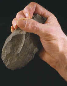
STATUES WERE MADE OF VOLCANIC TUFF
BY STONE PICKS OR HAMMERSTONES CALLED "TOKI" THAT WERE
MADE OF HARDER BASALT
EASTER ISLAND
PICTURE CREDIT GEORGE
FRISON
The large statues and stone blocks for platform building were shaped and
cut from the quarries with hand axes called hammerstones, picks or "toki".
These represent the majority of stone cutting tools found on the island
and have been found most concentrated in the quarry debris at Rana Raraku
(the statue quarry). The basalt pick or hammerstone in the picture above
is a good example of what Thor Heyerdahl calls a variety 2 basalt implement.
These basalt hand axes are unique to Easter Island and are not reported
from other Polynesian Islands.
|


